Overview:
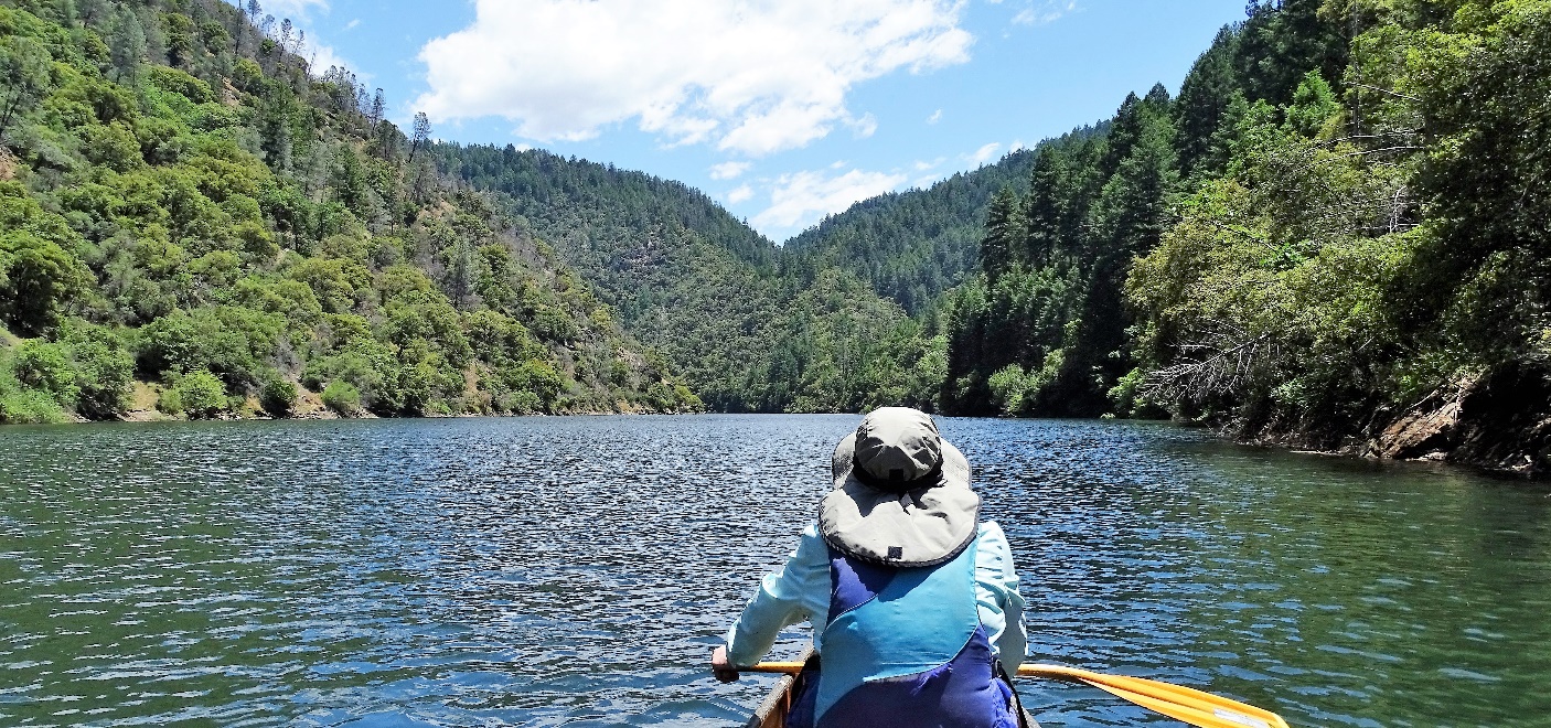
Slab Creek Reservoir (SCR) is a beautiful favorite day paddle of many who come here. It is long and narrow, with steep mountains and thick forests. The banks are lined with layered rock formations like nowhere else. All this scenic beauty reflects in the mirror-like water for amazing visual spectacles. The elevation of 1850' makes it a great paddle any season, and its zig-zag shape limits wind and waves. It’s never crowded, so the solitude and scenery combine to create a near religious paddling experience. Two waterfall side-hikes complete the show.It’s remote, so don’t go here with a storm or darkness approaching. There are no restrooms and very few spots to take-out due to the steep banks, so plan accordingly. Dress and equip yourself as you would for any wilderness outing.
Important: Choose between Upper and Lower Put-ins before your trip: Know SCR’s water elevation in the days before your trip so you can safely launch and return in flat water at the Upper Put-in, or are prepared for road and parking limitations at the Lower Put-in.
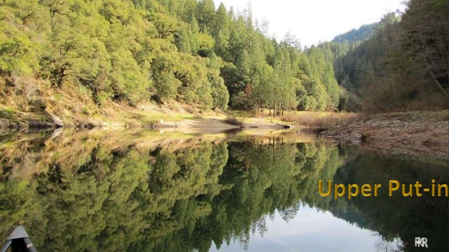
The Upper Put-in is the very top of the reservoir, where the So. Fork American River flows in. Water level and inflow change the conditions there drastically. Inflow is unknowable and can change dramatically while you are on the reservoir. Lake elevation changes more slowly, and is the key to using the Upper (East) Put-in. Find lake elevation level here: http://www.dreamflows.com/graphs/day.622.php
Elevation Guidelines: Lake elevation has no schedule or pattern. Check recent history in the days before your trip, then re-check the morning of your trip and consider the following guidelines:
- <1836' Use Lower Put-in. The entire Upper Put-in area is river, not lake. Still a great paddle!
- 1836-1838' Lower Put-in recommended. Only use the Upper end if you are skilled and equipped to cross fast current and waves, or drag/carry your boat back upstream to the beach. You may not need to do this near 1838' if inflow is low, but don’t rely on that. Upper Put-in might be flat-water when you depart, but inflow could change making return difficult.
- 1838'-1842' Gray area. At Upper Put-in you can have flat water at launch but might face current to get back at the end of the day if inflow increases. Consider using Lower Put-in depending on your group skill, boats and gear, ‘adventure quotient,’ and where in this range elevation is.
- 1842'–1850' Upper Put-in should be fine. You should have access to flat water regardless of inflow changes. Lake level changes gradually – it’s unlikely to drop enough during your paddle to trouble your return regardless of normal changes to inflow.
- >1850' the reservoir is spilling uncontrolled. This is now a slow, wide river, not a lake. But a level of 1852' or less and dropping is still doable as a flat-water paddle from either Put-in for strong, experienced, equipped paddlers. It’s best to avoid SCR when spilling and rising.
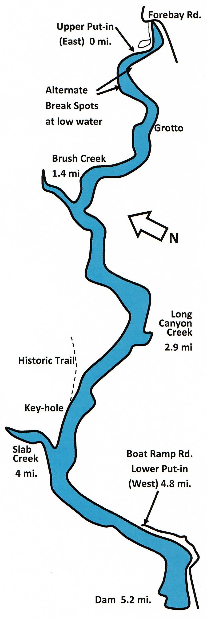
Upper Put-in – Forebay Rd. (East end):
Coordinates: 38.79412, -120.62982 or 38° 47' 39" N 120° 37' 47" WTake Hwy 50 Eastbound in Pollock Pines exit #60-Sly Park Rd. Turn left on Sly Park Rd., go .2 mi, turn left on Pony Express Trail, turn right on Forebay Rd., at several intersections stay to your left and stay on Forebay 8 miles. It will cross the river, then immediately turn left through a dawn-dusk automatic gate. Proceed down short dirt drive to the lot. Go to the far end of the dirt lot. From here it is a 400 ft. walk to the water, a gradual slope, suitable for boat-carts, with a sandy Put-in. Unload, then move your car so others may do so. No fees or facilities here (porta-potty sometimes). There are occasional campers. (Halfway through the lot is a shorter, steeper, 250' trail to the water, non-cartable, and usually with current.)
It’s a good idea to carry the coordinates of the alternate put-in, in case you must divert last minute, 45 minutes. Another plan B is Jenkinson Lake - 30 min. from Upper Put-in, 40 min. from Boat Ramp Rd.
Upper Put-in Advantages:
- Any car can get there, with paved roads, and a good dirt driveway and parking area.
- Plenty of parking for club, group trips.
- Prioritizes the prettiest mileage - Slab Creek and above. No need to paddle beyond 8 miles.
- Places the prettiest lunch spot, and possible side-hike, Slab Creek, at the half-way point.
- Puts most afternoon wind at your back on the return instead of in your face.
The Paddle from the Upper Put-in:
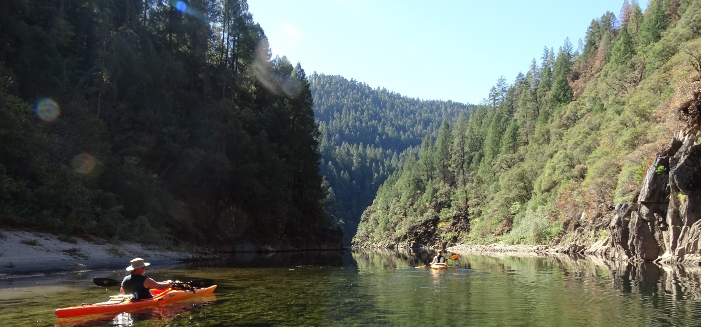
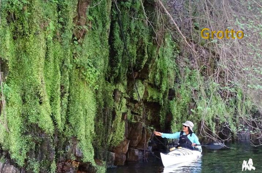
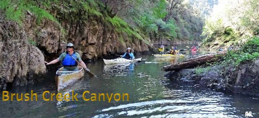
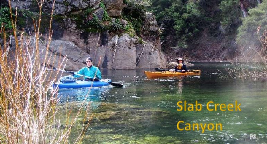
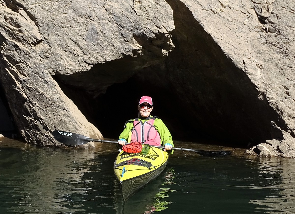
From the Upper Put-in, the first few hundred yards are shallow and usually beautifully clear. Schools of fish, lush pine forests and rock formations greet you right away. There is some damage from the King Fire, less near the water, worse on ridgetops. A way down along the left wall is the “Grotto” where a tree hangs over a moss-covered rock wall, dripping water most of the year – a good photo spot. After 1.4 miles Brush Creek Canyon veers to your right. Paddle up this scenic narrow canyon. The creek itself is nothing special, but it provides a rare takeout if needed. This canyon can ice over in winter cold spells. Back in the main channel, about 500' further on your left is a rock shelf with a campsite atop - the exit and short climb is steep and legality of camping is unknown. At 2.9 miles is Long Canyon Creek on your left. You can usually feel nature’s air conditioning blowing cool air down this canyon onto the lake. (Side hike details below.) At about 3.7 miles on the right is a historic rock trail angling up the mountainside. Whether this is part of the old Pony Express Trail, or an old Logger’s trail, is for your group to argue about! Just after is the “keyhole” in the rock - big enough to paddle into if the water is right. At 4.0 miles is Slab Creek Canyon on your right. This is a beautiful side canyon, with a gravel beach and/or sculpted rocks to sit on (depending on water level), a clear pool, pretty creek and year-round flow – a great lunch spot. (Possible side-hike details below)
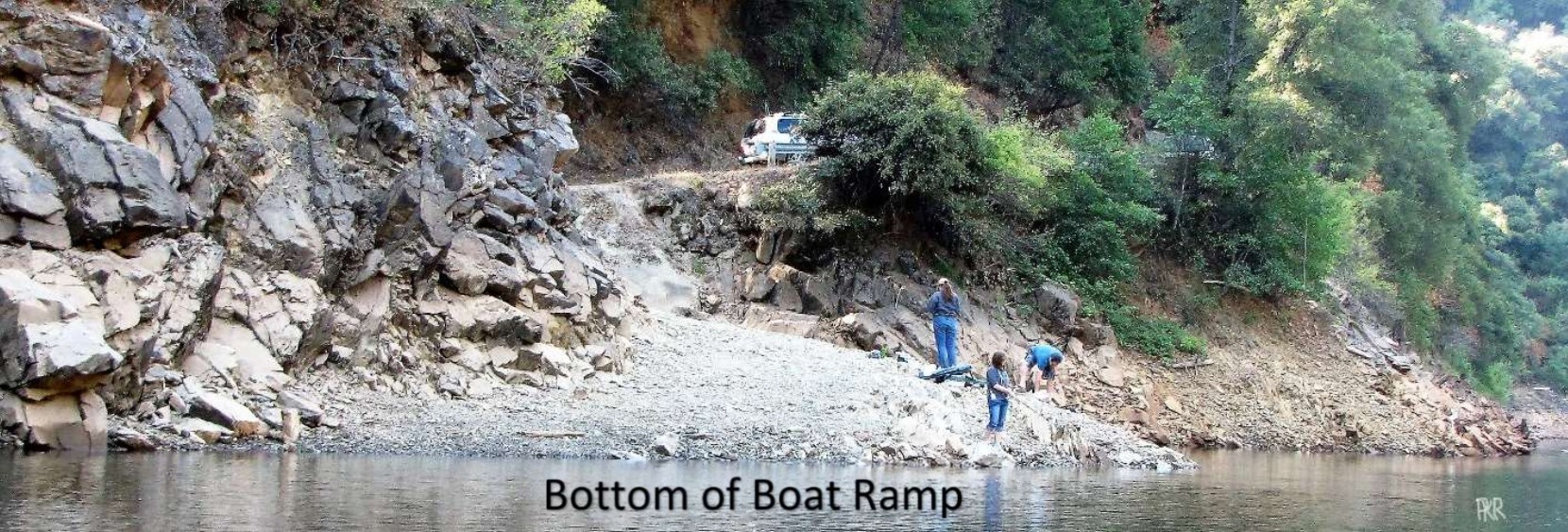
From Slab Creek, you can return 3.4 mi. straight to the put-in for an 8 mile paddle - the best miles!! Or, go another .8 miles to the Boat Ramp on the left, or 1.2 miles to the dam. The dam plus the side canyons is 10.5 miles round trip.
If you have somehow managed to confront current on your return, try wet-walking your boat along the far bank upstream of the take-out, then ferrying across and down the current to the eddy by the beach.
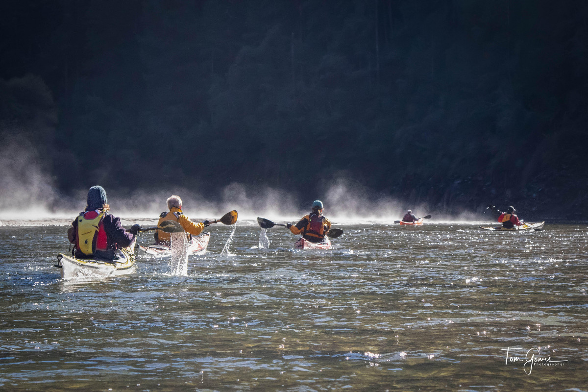
This paddle is beautiful year-round, high or low water. There’s swimming in the Summer, color in the Fall. In the winter it is very pretty – mist on the water, lush carpet-moss and ferns, water trickling down the walls, and sometimes icicles and heavy carpet-frost. The amazing mirror-like reflections are very common in the Summer, Fall, and Winter, less in Spring and after storms when water can be less clear.
Lower Put-in - Boat Ramp Rd. (West end):
Coordinates: 38.77815, -120.69009 or 38° 46' 41" N 120° 41' 24" WYou can use the lower (West) Put-in at any lake level. Lower levels expose more of the interesting slabbed rock. But, the roads are dirt, steep and narrow, and the parking limited. Minimize the number of appropriate vehicles you take here. Consider going early or weekdays to insure available parking.
AWD with some clearance recommended, no trailers. From Hwy 50 eastbound in Placerville, exit 48 Snell School Rd., turn left on Snell School Rd., go .3 mi., turn right on Carson Rd., go 2.9 mi. and slow down so you don’t miss veering left on North Canyon Rd., go 2.3 miles, turn left on Slab Creek Reservoir Rd. and proceed past a dawn-dusk automatic gate. Go 1.4 mi. on the sometimes steep, gravel road. You will come to a level wide area with roads down to the left, center to the dam, and up on the right. Take the narrow road uphill on the right - Boat Ramp Rd. Proceed slowly .9 mi. on this narrow 1-lane, rocky, side-of-a-mountain, 2-way road to the very limited parking area. Keep an open turnout between your vehicles (don’t create your own gridlock). Turn around first and back carefully down the boat-ramp to unload. Then park, facing uphill, along the guardrail or above the culvert. Leave an open spot in the center of the guardrail – this is the turnaround! The 5-6 parking spots can fill up. The boat ramp gets you close to the water down to about 1830' but is still usable with a non-cartable carry below that. No fees, no facilities. 25 min. from Placerville. Road damage or downed tree limbs are possible after storms. Beware weekend gridlocked roads in apple and Christmas tree seasons.
Paddling from the Lower Put-in:
Go right from the ramp. If your goal is to go to the top, it could be best to do that first then visit side canyons on the return. If the water is >1838' you can usually make it to the sandy Beach of the Upper Put-in 4.2 miles from the Boat Ramp. If water is lower and/or inflow is high, there is a rockier beach on the other (South) side just downstream. Even lower, a small sandy beach emerges on the North side another 5 minutes downstream. After a break, you can follow the paddling guide above on your return. Your paddle to the top plus side canyons and back will be minimum 9.6 miles round trip, and you may face some headwind on return. Saving the side canyons for later allows paddlers to measure their energy and time. If you are still going strong, you can pass the boat ramp and go to the dam for a 10.5 mile day.
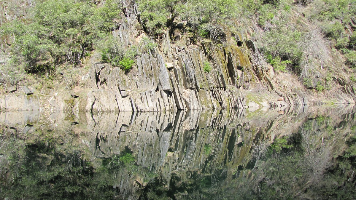
places where the
slabbed rock is on
display. When SCR
is in its ‘full mirror’
mode, the result is
like abstract art.
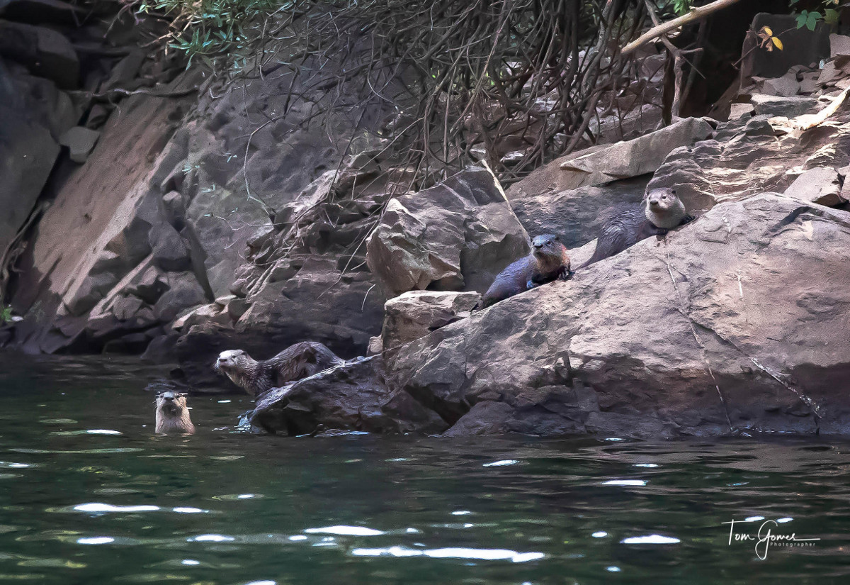
their home here. Photo
by Tom Gomes.
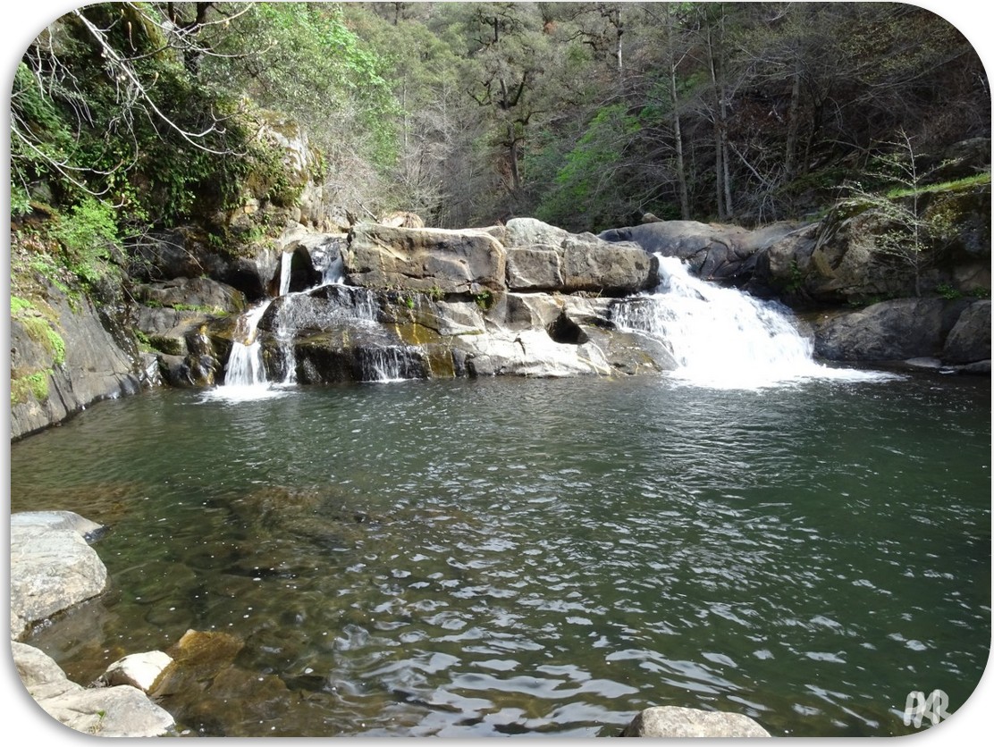 From the creek mouth, walk straight up the creek then alternate between the creek-bed and either bank for 900 feet.
You will come to
From the creek mouth, walk straight up the creek then alternate between the creek-bed and either bank for 900 feet.
You will come to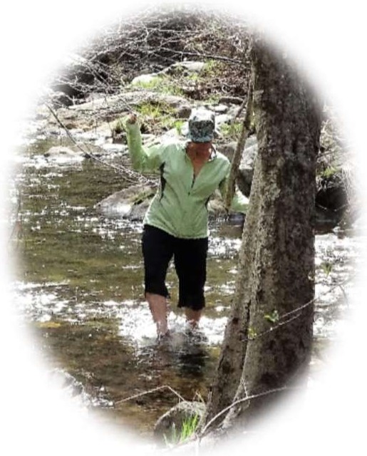
a pool beneath a pretty waterfall. This could be great swimming in summer, but the brambles/poison oak grow thicker then. It’s clearer in Winter-Spring. Easier but longer than the Long Canyon hike, it’s a 30 min. round trip minimum. Imagery shows more falls above, unexplored by me.
 Take-out at the base of the creek.
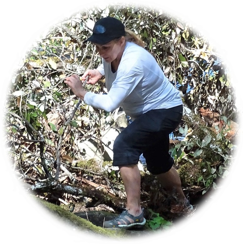
Walk up the creek or over the brambles on the right, then along a semi-trail on the right over logs,
slippery rocks and through the water.
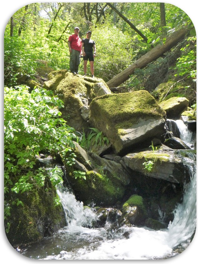
About 300 ft. up, just out of view of the lake, is a mossy waterfall.
Best in winter-spring before the brambles and poison oak grow thick - not for everyone.
An exploratory hike above this waterfall was steep and unsuccessful.
Take-out at the base of the creek.
Walk up the creek or over the brambles on the right, then along a semi-trail on the right over logs,
slippery rocks and through the water.
About 300 ft. up, just out of view of the lake, is a mossy waterfall.
Best in winter-spring before the brambles and poison oak grow thick - not for everyone.
An exploratory hike above this waterfall was steep and unsuccessful.
Narrative copyright 2018. Contact Paul Redd. This page was last updated Dec 13, 2018.